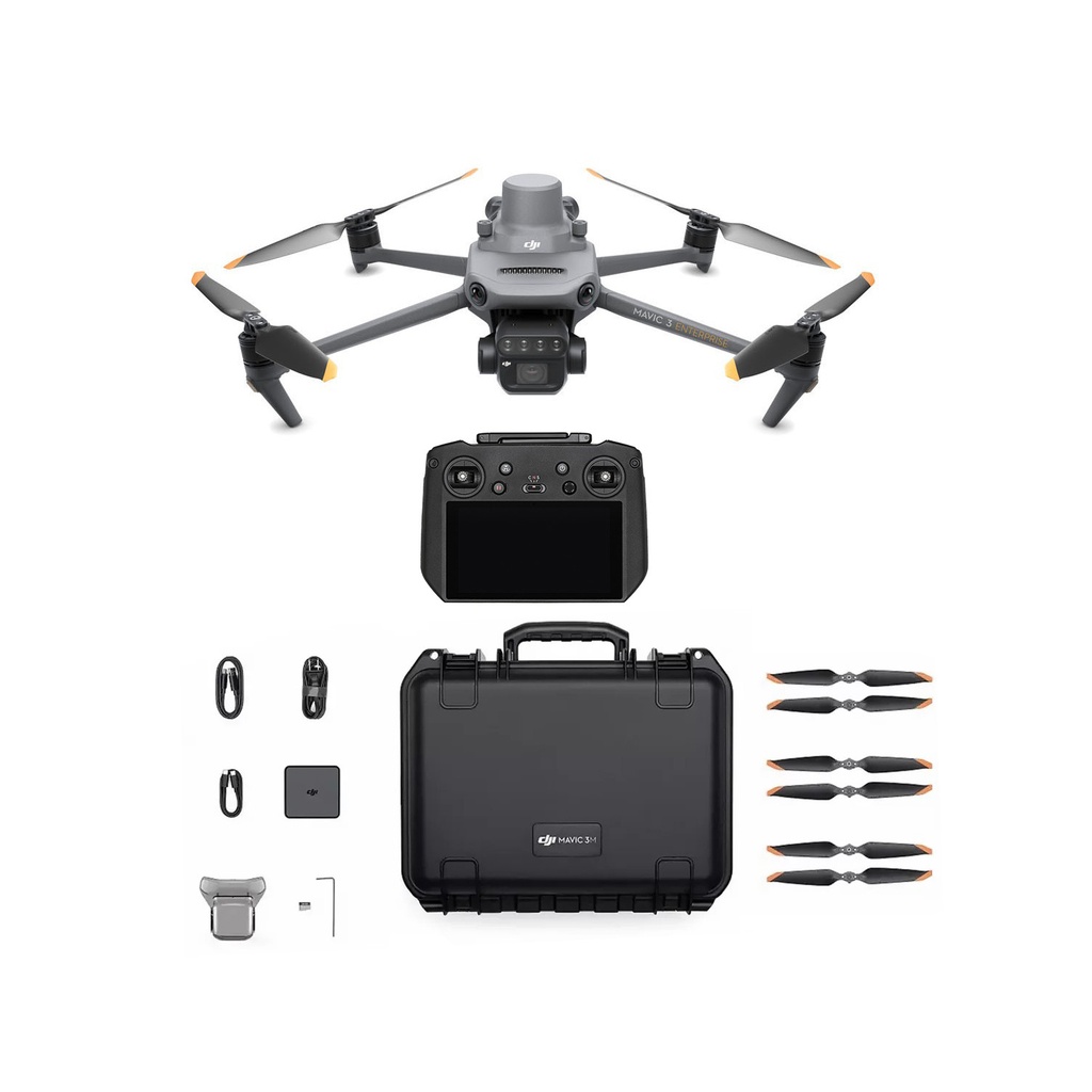
DJI Mavic 3 Multispectral Worry-Free Plus Combo (C2)
Contacteer ons
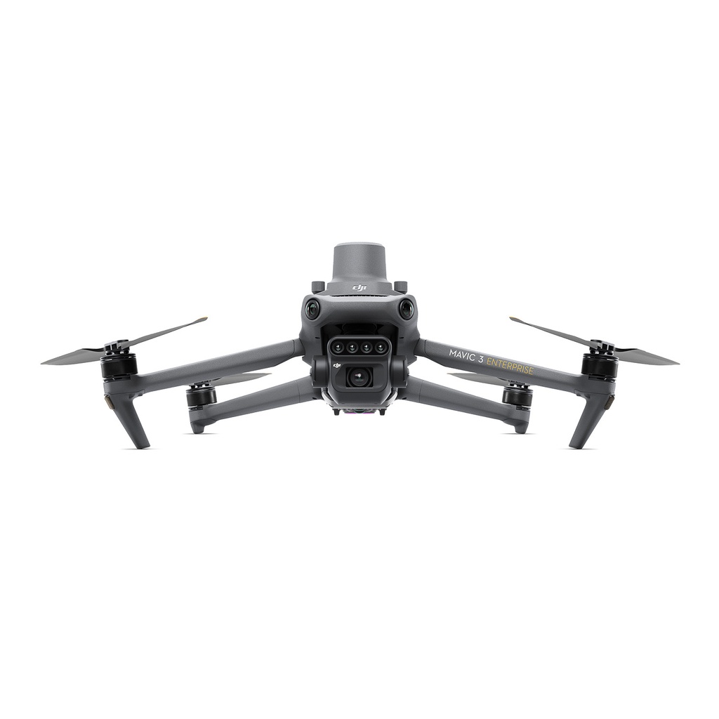
To conduct thorough aerial surveys, visibility beyond the obvious is vital. That's why the Mavic 3 Multispectral (Mavic 3M) combines an RGB camera with a multispectral one for precise crop analysis. With one 20MP RGB camera and four 5MP multispectral cameras (green, red, red edge, and near infrared), it's perfect for high-precision surveys, crop monitoring, and natural resource assessments.
This combo is immediately compliant with the new Cx regulations as of January 1, 2024, with the C2 designation.
The Worry-Free Basic Combo provides up to two affordable replacements. After paying the corresponding replacement fee, you can have your damaged product replaced with a well-functioning one*. The Worry-Free Plus Combo provides a coverage amount equivalent to the product's value.
specs
|
Brand |
DJI |

RGB / Multispectral camera specifications
- Near-infrared (NIR) 860 nm ± 26 nm
- Red edge (RE) 730 nm ± 16 nm
- Red (R) 650 nm ± 16 nm
- Green (G) 560 nm ± 16 nm
- RGB camera characteristics 4/3 CMOS
- 20MP image sensor
- 1/2000s Fastest mechanical shutter speed
- 0.7s High-speed burst when RGB camera is used
Sunlight Sensor
The built-in sunlight sensor captures solar irradiance and records it in an image file, allowing for light compensation of image data during 2D reconstruction. This results in more accurate NDVI results, as well as improved accuracy and consistency of data acquired over time.
Accurate images that capture every pixel
Mavic 3M with RTK module for centimeter-level positioning. Flight control, the camera, and the RTK module sync in microseconds to accurately capture the location of each camera's imaging center. This enables Mavic 3M to do high-precision aerial surveying without using ground control points.
Efficient and reliable battery life
Ultra-long battery life, fast bursts
43 minutes Cruise time
A single flight can complete mapping operations over an area of 200 hectares.
Fast charging
100W Battery Charging Hub
High-efficiency fast charging
88W fast charging Aircraft
Omnidirectional obstacle sensing, terrain-follow aerial surveying
The aircraft features multiple wide-FOV vision sensors that accurately detect obstacles in all directions for omnidirectional obstacle avoidance. The terrain-follow aerial surveying can be easily performed in steep-slope landscapes.
Applications
Orchard mapping
Mavic 3M allows terrain-follow aerial surveying of orchards, even on sloped landscapes. Together with DJI Terra or DJI SmartFarm Platform to reconstruct high-resolution orchard maps, automatically identify the number of trees, distinguish trees from other obstacles or objects, and generate three-dimensional operation routes for agricultural drones, making operations safer and more efficient.
Guide variable rate applications
For rice fertilization, cotton growth regulation, and potato foliar fertilizer spraying, the Mavic 3M is used to obtain multi-spectral images of crops. DJI Terra or the DJI SmartFarm Platform [6] can then generate NDVI and other vegetation indices maps, capturing differences in crop potential and generating prescription maps that allow agricultural drones to execute variable-rate application. This ultimately allows users to reduce costs, increase yield, and protect the environment.
Intelligent field scouting
The Mavic 3M can carry out automatic field scouting. The field scout images can be uploaded to the DJI SmartFarm Platform [6] in real time through a 4G network. It can find abnormalities, such as emergence deficiencies, weed pressure, and crop lodging in a timely manner. It can also conduct intelligent analyses, such as cotton seedling identification and rice production testing, using AI identification for real-time sharing of crop growth information, guidance of agronomic activities, and easy management of 70 hectares of farmland by one person.